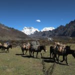
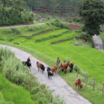

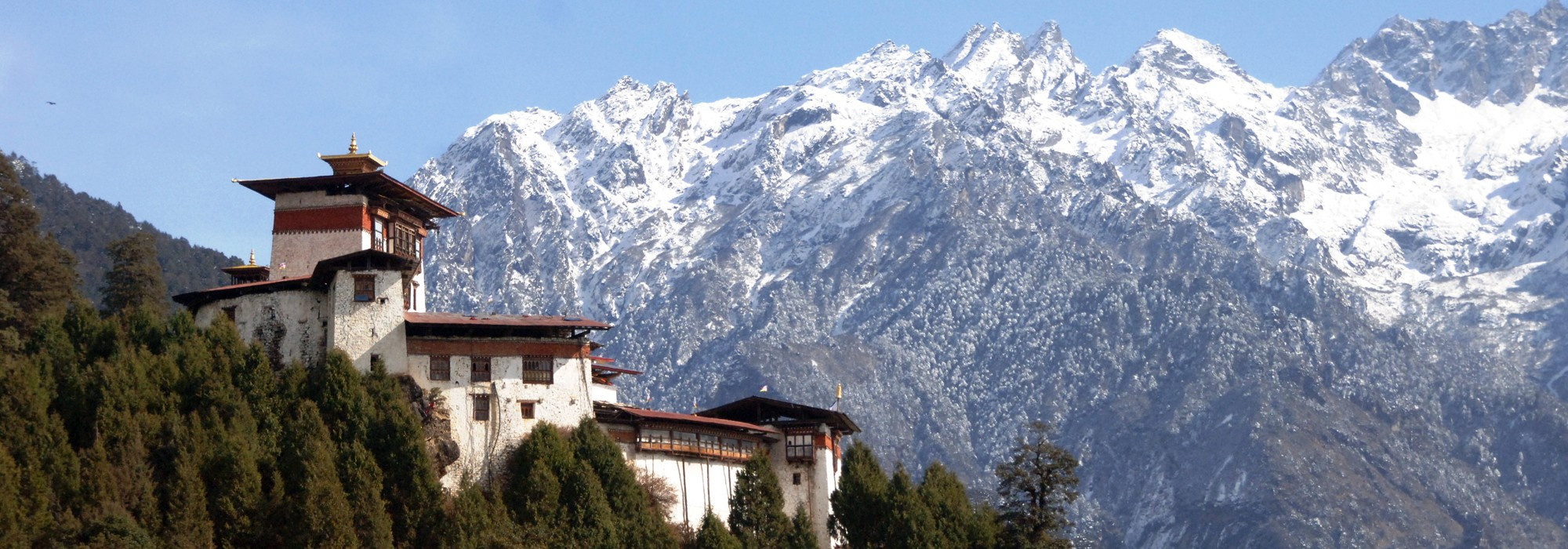
Paro valley extends from the confluence of the Paro Chhu and the Wang Chhu rivers at Chuzom up to Mt. Jomolhari at the Tibetan border to the North. This picturesque region is one of the widest valleys in the kingdom and is covered in fertile rice fields and has a beautiful, crystalline river meandering down the valley.
Accentuating the natural beauty are the elegant, traditional-style houses that dot the valley and surrounding hills. One of the distinctive features of Paro town is that it is situated in a flat valley bottom and follows a grid-like pattern. The central plaza is adorned with a large prayer wheel and a small amphitheater where events are held throughout the year.
There are over 155 temples and monasteries in the area, some dating as far back as the 14th century. The country’s first and only international airport is also located in the region. Its close proximity to the historical and religious sites in the region has resulted in the development of an array of luxurious, high-end tourist resorts making Paro one of the main destination for visitors.
The region contains one of Bhutan’s most iconic landmark, Taktsang Monastery, the Tiger’s Nest. This awe-inspiring temple was constructed upon a sheer cliff face, above forests of oak and rhododendrons. The national museum, Ta Dzong, is also set in Paro. An ancient watchtower that displays hundreds of ancient Bhutanese artefacts and artwork including traditional costumes, armour, weaponry and handcrafted implements for daily life. The collection at the National Museum preserves a snap-shot of the rich cultural traditions of the country. Another site worth visiting in Paro is Drugyel Dzong or The Fortress of the Victorious Bhutanese. It was constructed by Zhabdrung Ngawang Namgyal in 1646 to commemorate his victory over marauding Tibetan armies. The fortress was destroyed by fire in 1951 but the ruins remain an impressive and imposing sight.

The Kingdom’s capital city is home to approximately 100,000 inhabitants including the Royal family. This bustling little city is the main centre of commerce, religion and government in the country. The juxtaposition of ancient tradition and modernity make Thimphu the ideal location for visitors to break away from their tour itinerary to immerse themselves in the contemporary Bhutanese lifestyle.
Thimphu is the most modern city in Bhutan with an abundance of restaurants, internet cafes, nightclubs and shopping centres. However, it still retains its’ cultural identity and values amidst the signs of modernization. Thimphu is one of the few towns in Bhutan that have been equipped with ATM banking facilities and is a good place to stock up on some currency.
There are several attractions in Thimphu such as the National Post Office, the Clock Tower Square, the Motithang Takin Preserve, Tango and Chari Monasteries, Buddha Dordenma, National Memorial Chorten, Centenary Farmer’s Market, Semtokha Dzong to name a few. These form the most important tourist attractions in the capital city.
The culture of Bhutan is fully reflected in Thimphu in respect of religion, customs, national dress code, the monastic practices of the monasteries, music, dance, literature and the media. Tshechu is an important festival where mask dances, popularly known as Chams, are performed in the courtyards of the Tashichho Dzong in Thimphu. It is a four-day festival held every year during autumn (September/October), on dates corresponding to the Bhutanese calendar. One of the most curious features of Thimphu is that it is the only capital city in the world that does not use traffic lights. Instead, a few major intersections have policemen standing in elaborately decorated booths (small pavilions), directing traffic with exaggerated hand motions.
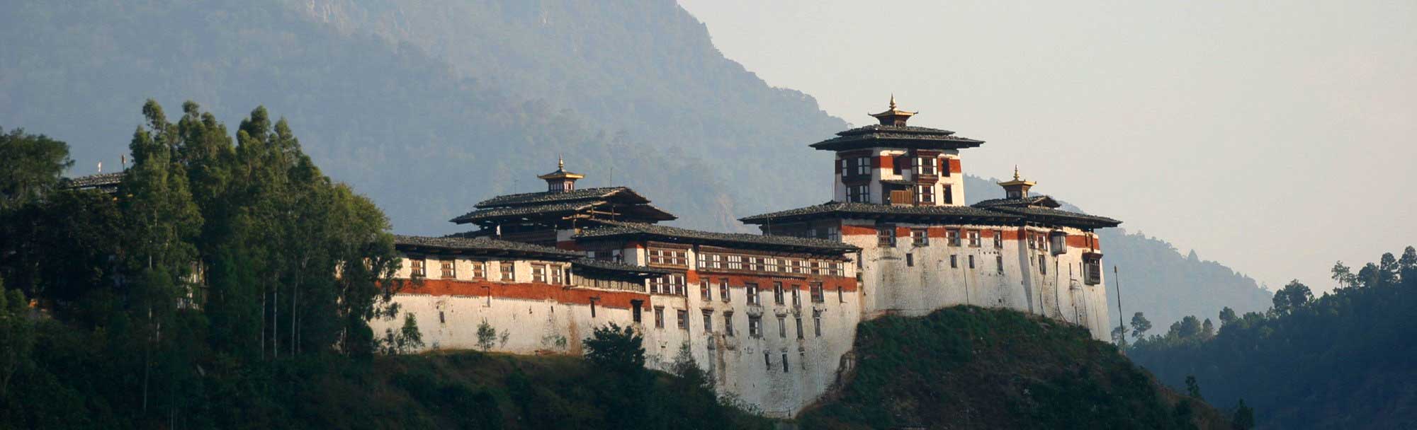
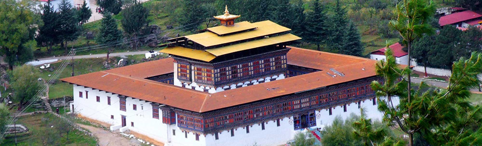
Punakha Dzongkhag (Dzongkhag means “District”) has been inextricably linked with momentous occasions in Bhutanese history. It served as the capital of the country from 1637 to 1907 and the first national assembly was hosted here in 1953. Punakha Dzong is not only the second oldest and second largest dzong but it also has one of the most majestic structures in the country.
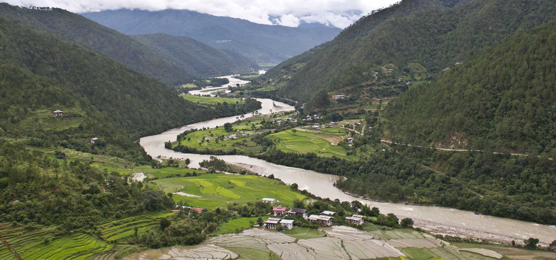
October 13, 2011 marked an unforgettable wedding of the King of Bhutan, Jigme Khesar Namgyel Wangchuck to Jetsun Pema which was held at Punakha Dzong. Punakha Dzong was built at the confluence of two major rivers in Bhutan, the Pho Chhu and Mo Chhu, which converge in this valley. It is an especially beautiful sight on sunny days with sunlight reflecting off the water onto its white-washed walls.
In addition to its structural beauty, Punakha Dzong is notable for containing the preserved remains of Zhabdrung Ngawang Namgyal, the unifier of Bhutan as well as a sacred relic known as the Ranjung Karsapani. This relic is a self-created image of Avalokiteswara that miraculously emerged from the vertebrae of Tsangpa Gyarey, the founder of the Drukpa School when he was cremated.
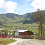
Punakha valley has a pleasant climate with warm winters and hot summers. It is located at an average elevation of 1200 m above sea level. Owing to the favourable climatic conditions, rice has become the main cash crop cultivated in the region.
Wangdue Phodrang is one of the largest Dzongkhag means “District”dzongkhags in the country. As the district covers 4,308 sq. km and ranges from 800-5800 m in altitude, it has extremely varied climatic conditions ranging from subtropical forests in the south to cool and snowy regions in the north.
Most of Wangdue Phodrang District is environmentally protected. The northern half of the district falls within the Wangchuck Centennial Park, with northwestern pockets belonging to Jigme Dorji National Park. Southeastern Wangdue is part of Jigme Singye Wangchuck National Park. Also protected are the biological corridors crisscrossing the district that connect Bhutan’s extensive national park system. The dominant language in the region is Dzongkha, spoken in the western two-thirds of the district. Communities along the border with Bumthang District in the northeast speak Lakha. Along the same border, in central Wangdue Phodrang, inhabitants speak Nyenkha. In the southeast region, remnants of the autochthonous ‘Olekha (Black Mountain Monpa) speaking community barely survive.
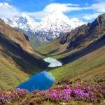
One of the most notable sites in the district is Phobjikha Valley. This valley is the habitat of the rare and endangered Black Necked Cranes that roost there during their annual migrations. The residents of the valley have garnered much acclaim for their conservation efforts to preserve the habitat of these beautiful birds. Every year the Black Necked Crane Festival is held in Phobjikha in order to protect and spread awareness of the cranes. The festival includes songs, masked dances and plays by the local school children. This event is one of the most unique and popular festivals in the country.
With its diverse climates and rich natural resources, Wangdue Phodrang Dzongkhag is home to many rare and exotic animals like Red Pandas, Tigers and Leopards. There are also large numbers of rare birds such as the Black Necked Crane, White-Bellied Heron and the Spotted Eagle.
Gasa, the northernmost district of the country adjoins the districts of Punakha, Thimphu and Wangdue Phodrang and with Tibet to its north. This starkly beautiful region with elevations ranging from 1500 to 4,500 m experiences extremely long and cold winters and short but beautiful summers.
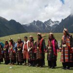
It has the smallest population with just about 3000 inhabitants. This region is inhabited by the Layaps; nomadic herders with a unique culture. Their main source of revenue comes from trading products made from their yaks, such as yak hair textiles, cheese, butter and yak meat. They also harvest and sell Cordyceps, (a fungus of extremely high value that is frequently used in oriental medicine). The majority of the known herds of wild Takin also occur in Gasa.
Gasa has become a tourist destination because of its pristine forests and the exceptionally scenic location of its Dzong. A narrow road from Punakha, which is mostly unpaved, reaches up to the Dzong and is now being extended up to Laya. Gasa Dzong was built by Zhabdrung in 1646 to commemorate the victories over the Tibetans and it later defended the country against several invasions in the 17th and 18th century.
Gasa is famously known for its inhabitants, the Layaps, and for the Snowman Trek – one of the most challenging treks in the Himalayas. The newly established festival called the Royal Highlander Festival is becoming more popular each year. Attending this festival allows you to see the real feature of this remote Dzongkhag and should not be missed by travellers. Gasa is also famous for its healing hot springs, located around 2hrs walk at the bottom of the ridge. The hot spring is popular amongst Bhutanese all over the country during the winter.
Located in South West of Paro and covering an area of roughly 1706 sq. km, Haa is one of the smallest Dzongkhag in the country. This tiny region is one of the most beautiful and isolated areas in the kingdom, adorned with pristine alpine forests and tranquil mountain peaks.
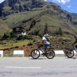
Haa is the ancestral home of the Queen Grandmother and the illustrious Dorji family. This valley remains one of the least visited areas in the country and retains the air of an unspoiled, primeval forest. The wooded hills of Haa provides an ideal location for hiking and mountain biking. Biking around the valley to visit the dozen or so local temples is an enjoyable way to spend the day when visiting.
Haa is home to a number of nomadic herders and hosts an annual Summer Festival that showcases their unique lifestyle and culture. The festival is an ideal occasion to immerse yourself into the traditions and unchanged lifestyles of nomadic Bhutanese herders, as well as to sample some delectable Haapi cuisine.
Haa’s major feature is the Haa Valley, a steep north-south valley with a narrow floor. The name Haa, connotes esoteric hiddenness. An alternative name for the district is “Hidden-Land Rice Valley.”The main crops grown in the valley are rice, wheat and barley. Other cash crops such as potatoes, apples and chilli’s are also grown by farmers on the valley floor, along terraced hillsides and in some of the more accessible side valleys. The region comprises of the Torsa Strict Nature Reserve, one of the environmentally protected areas of Bhutan. It occupies a substantial proportion of Bji and Sangbay gewogs but there are no inhabitants in the Reserve. Torsa is connected to the Jigme Dorji National Park via a biological corridor, cutting across the northeastern half of Haa District.
Dagana is a verdant region and over 80% of the district is under forest cover. Hardy trees like Champ, Augury, Chirpine and Sal grow throughout the region. Located below the major valleys of Thimphu and Wangdue Phodrang, Dagana stretches all the way down to the southern border of the kingdom.
The place gets its name from the historic Daga Trashiyangtse Dzong which was established in 1651 by Zhabdrung Ngawang Namgyel, the first man to unify Bhutan. This historic landmark still functions as the district administration centre today. The district is mainly inhabited by two major ethnic groups, the Ngalops and the Lhotshampas. Although, in recent years, people from other regions have migrated to the region. This has added to the cultural diversity of the region with the introduction of new festivals and traditions.
One of the more interesting features of Dagana are the three stone Megaliths, known as “Sky Pillar Rock” (Do Namkhai Kaw), “The Rock of Ancient Steps” (Do Kelpai Genthey) and “The Frontier Sky Fortress” (Tha Namkhai Dzong). Legend has it that when Daga Trashiyangtse Dzong was being constructed, the megalith known as the Frontier Sky Fortress emitted telepathic messages to the builders stating that the Dzong would collapse if it was built any higher than it currently stands. Even today the golden cupola of the Dzong is said to be level with the tip of the megalith.
Similar to all Dzongkhags, there are Buddhist temples and monasteries throughout the district. Two temples that elicit special mention are the Shathong Lhakhang, founded by the Buddhist Master Dupthob (Siddhi) Shawa Ripa and the Nyindukha Lhakhang founded in the 18th century. Shawa Ripa is an ancient Buddhist Master that is said to have lived for over 900 years. Agriculture is the main source of livelihood for the inhabitants of the Dzongkhag. Two of the main crops cultivated in the region are oranges and rice.
Chhukha is a hot and wet region located in the dense subtropical forests in Southwestern Bhutan. The region is home to many important plant and animal species.
There are two main ethnic groups present in Chhukha, the Ngalops and the Lhotshampas. The Lhotshampas are Southern Bhutanese with Nepalese origins and this creates a wealth of cultural diversity in the region with various non-Buddhist festivals and practices being carried out.
Chhukha region is religiously significant as it has been blessed by many renowned Buddhist masters including the venerable Lama Drakpa Jamtsho in the 17th century. He established the Jabar Goemba Monastery at a site surrounded by five mountains with an auspicious resemblance to the five religious hats worn by lamas. The main relic of this monastery is a holy Phurba or ritual dagger that is said to have flown to the monastery from Tibet. Legend holds that the dagger continues to defy gravity to this day
Another important religious site in the region is the Tshamdrak Goemba. This monastery dates back to the 17th century and was founded by Lam Ngawang Drakpa. It contains important relics such as the 100 Ceremonial Drums and a large stone slab that is attributed to Ap Chundu, the guardian deity of Haa. The most distinctive feature of Chhukha is the Chhukha and Tala Hydropower projects. The two projects tap the fast-running waters of the Wang Chhu and Paa Chhu to produce more than 1,500 megawatts of power. These two dams are absolutely crucial to the country as they are still the largest providers of revenue for the Kingdom.
Located in Southern Bhutan, Samtse Dzongkhag covers an area of 1,582 sq.km and ranges from 600-3,800 m in altitude. The main crops grown in the region are oranges, cardamom, ginger, and areca nuts. These cash crops are exported to the nearby Indian state of West Bengal and even to Bangladesh.
The population of Samtse is divided into two main ethnic groups, the Lhotshampas and the Doyas. Smaller groups of Bumthaps, Tshanglas, Ngalongs, Khengpas and Kurtoeps have also started inhabiting the region in recent years. Samtse is a religiously diverse district and both Hinduism and Buddhism are widely practiced in the dzongkhag. Visitors will find temples belonging to both religions all over the beautifully forested district. The main festivals celebrated in the region include Losar (New Year), Thrue and Lomba by the Buddhists and Diwali and Dussehra by the Hindus.
With its’ hot and humid climate, Samtse has a rich diversity of flora and fauna. One of the more exotic animals found in this district are the local elephants, some of which have been domesticated. Though the main form of employment remains agriculture, there are also agricultural and construction based industries in Samtse. Minerals like Dolomite and Quartzite are mined at Pugli, providing raw materials for two major cement plants. Agricultural industries in the area are Samtse’s Fruit and Food Products Factory and the Cardboard Factory.
One of the most important facets of the Dzongkhag is the Samtse College of Education. It was started in 1968 and has provided the country with countless valuable teachers. This college is widely considered to be one of Bhutan’s premier educational institutions.